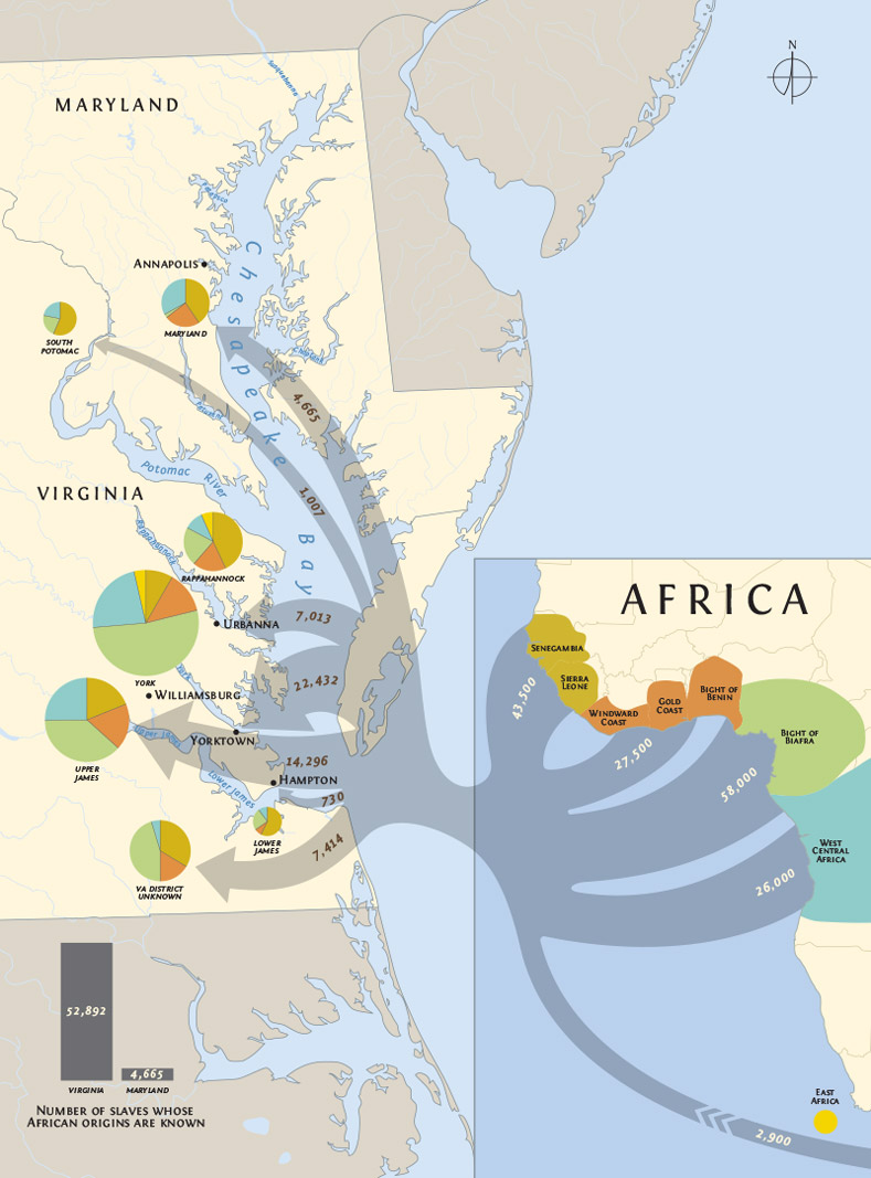
All maps are information graphics, but this one also combines pie charts and appropriately-sized arrows to show which areas of the Chesapeake imported slaves from which areas in Africa and in what numbers. This map was created while working at StudioAmmons, Inc., for The Chesapeake House: Architectural Investigation by Colonial Williamsburg, edited By Cary Carson and Carl R. Lounsbury. It is used here by permission from the Department of Architectural Research, Colonial Williamsburg Foundation.